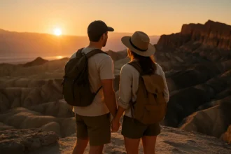
Grand Canyon hikers planning for inner canyon trails after the August 29, 2026 flash flood need to treat the trip as a live access issue, not a normal backcountry booking. As of mid-September 2026, key corridor routes, bridge access, Phantom Ranch services, campground access, and potable water availability had been disrupted. The practical effect is simple: plans that once relied on established water stops, corridor trail connections, and overnight stays may no longer work without major changes.
The National Park Service expanded closures on September 3, 2026, after the flash flood damaged Bright Angel Canyon and the Phantom Ranch area. The expanded closure included South Kaibab Trail below Tip-Off and Bright Angel Trail below the Tonto Trail intersection, according to the park’s September 3 closure notice. For hikers, those named trail sections matter because they are part of the most familiar South Rim-to-river planning pattern.
This is also a transportation and timing issue. Visitors arriving through regional airports or combining flights with long drives should avoid building tight plans around a single trail objective. For comprehensive advice on air-and-road trip planning, checking Vision Airlines offers a useful perspective as it is part of a related travel network.
What Changed On Inner Canyon Trails
Inner Canyon Trails With No Reopening Date
As of September 6, 2026, park updates reported no estimated reopening date for the closed sections. That uncertainty should shape every decision. A hiker who booked around a river crossing, Phantom Ranch stay, or rim-to-rim route should not assume that a partial reopening will happen before a travel date. Reopening depends on ground conditions and safety assessments, and those are not fixed calendar items.
The closure picture also reaches beyond two named trail segments. Research notes from park updates identified the entirety of Phantom Ranch, including cabins and canteen, Bright Angel Campground, North Kaibab Trail from the North Kaibab Trailhead to Phantom Ranch, including Cottonwood Campground, Black and Silver Bridges, and portions of River Trail east of River Resthouse among affected areas. For most hikers, that means the usual corridor network has been broken in several places at once.
The main planning change is that inner canyon trails should not be treated as interchangeable. A closure below one junction can remove the practical connection to another route, a campground, a water source, or a bridge. A route that looks open at the rim may still fail as a complete plan if its lower connection is closed.
Why Bridge And Campground Closures Matter
Bridge closures are not minor inconveniences in the Grand Canyon. The Black and Silver Bridges are core crossing points for corridor hikers. If those crossings are closed, hikers cannot simply assume that another nearby option is available within a normal day-hiking effort. Campground closures create a similar problem. Without Bright Angel Campground or Cottonwood Campground access, hikers lose established overnight nodes that usually support longer routes.
Phantom Ranch being closed for cabins and canteen services also changes expectations. A traveler who planned around meals, a bunk, shade, or a staffed stop in the canyon should now plan as if those services are unavailable until park updates say otherwise. This is especially important for people who secured earlier reservations or built a multi-day itinerary around the ranch area.
Water Is Now The Main Trip Constraint
The Transcanyon Waterline Problem
Water access is the most serious planning variable. The Transcanyon Waterline is the 12.5-mile pipeline that supplies potable water to the South Rim and inner-canyon corridor areas. The system had multiple breaks, and since mid-March 2026 the South Rim had no water pumped because of a break about one mile below Cottonwood Campground along North Kaibab Trail, according to the park’s August 2026 water notice.
As of September 6, 2026, research notes reported that all inner-canyon potable water sources were off, including resthouses along Bright Angel Trail, Havasupai Gardens, and the Phantom Delta Restroom area. That is a fundamental shift. Many hikers have historically used corridor water stops to reduce pack weight and manage heat. Under the reported conditions, that assumption would be unreliable.
For hikers considering inner canyon trails, the safest planning approach is not to ask, “Where can I refill?” The better question is, “Can this hike be completed if every expected water point is unavailable?” If the answer is no, the route should be shortened, postponed, or replaced with a rim-based option until official park updates change.
What To Carry And What Not To Assume
Hikers should carry enough water for the full planned duration and extra time, but they should also avoid treating filtration as a complete answer. Filtration or treatment can help only if a usable water source is present and legally accessible. With potable sources reported off and multiple areas closed, relying on a filter without confirming accessible water would be poor planning.
Water restrictions at the South Rim also affect the wider visitor experience. Lodging, food service, restroom access, and refill expectations can change when a water system is under stress. Travelers should confirm lodging status directly before departure, especially if a reservation was made before the late-August flood and the subsequent water restrictions.
Heat, Timing, And Physical Margin
Midday Heat Remains A Serious Factor
Heat risk did not disappear because flood damage became the headline. Research notes cite summer inner-canyon shade temperatures reaching about 109 degrees Fahrenheit, or 43 degrees Celsius, during midday hours from 10 a.m. to 4 p.m. Park guidance strongly advised hikers to avoid strenuous inner-canyon hiking during those hours. That advice becomes even more relevant when water points are off and route options are reduced.
The Grand Canyon reverses many casual hiking assumptions. Descending first can feel easy, while the harder return comes later, often in warmer conditions. With closures in place, a hiker may also be unable to continue to a planned exit, bridge, or rest point. A conservative start time, a shorter turnaround target, and a willingness to cancel are practical tools, not overreactions.
Why Day Hikes Need Stricter Turnaround Rules
Day hikers should use strict turnaround times and avoid pushing below known open-and-closed boundaries. A partial trail opening near the rim does not mean the lower canyon is available. If Bright Angel Trail is closed below the Tonto Trail intersection, for example, a hiker needs to understand where that boundary falls before committing to a descent.
With inner canyon trails affected by flood damage and water outages, day hikes should be planned with more margin than usual. That means more water, earlier starts, less distance, slower pacing, and a clear decision point for turning back. It also means checking for new closures on the day of departure, not only when booking a hotel or permit.
Rim-To-Rim And Arizona Trail Plans Need Reroutes

Long-distance plans face some of the hardest disruptions. Research notes show that the expanded closures affected thru-hiker itineraries on the Arizona Trail. As of August 31, 2026, 16 miles of the Arizona Trail within Grand Canyon were closed, removing connected Mexico-to-Utah routing through the canyon. Hikers were expected to reroute or shuttle around closed areas.
That affects more than thru-hikers. Anyone planning a rim-to-rim-style trip, a South Rim-to-Phantom Ranch itinerary, or a canyon crossing needs to check whether bridges, campgrounds, and trail segments create a complete legal route. A single closure can invalidate the whole plan.
For readers tracking access changes across roads, trails, and water updates, this related BajaTimes report on Grand Canyon closures gives a broader access snapshot. Because conditions have been changing, it should be used as context rather than a substitute for same-day National Park Service updates.
Booking, Permits, And Backup Plans
Do Not Build A Trip Around One Assumption
Travelers should expect lodging and backcountry plans to remain fragile until repairs, stabilization, and water service improve. The August 29 flood damaged trail, bridge, and utility infrastructure in Bright Angel Canyon and the Phantom Ranch area. Repairs and stabilization were underway, but no fixed reopening date was available in the research notes.
That means hikers should avoid nonrefundable commitments tied to one canyon objective where possible. If a trip requires a specific campground, canteen service, bridge crossing, or water source, the plan has a single point of failure. A stronger plan includes rim viewpoints, shorter maintained trails that remain open, scenic drives, and flexible lodging outside the most affected overnight areas.
A Practical Pre-Departure Checklist
- Check the latest National Park Service trail, water, and closure messages before leaving lodging or the trailhead.
- Confirm whether any reserved lodging or backcountry stay is still available.
- Carry enough water for the full hike if potable sources are off.
- Avoid strenuous hiking between 10 a.m. and 4 p.m. during extreme heat periods.
- Set a turnaround time before descending and follow it.
- Do not cross closure lines, even if a trail looks passable from above.
- Have a rim-based backup plan if the intended route is closed.
The most useful mindset is cautious flexibility. The canyon remains a major outdoor destination, but damaged infrastructure changes the risk profile. A hiker who would normally be comfortable on corridor routes may need to reduce distance and remove overnight goals until verified access returns.
Preparing For Inner Canyon Trails After Flood Damage
The extended closures have turned Grand Canyon trip planning into a day-by-day access decision. Hikers should prepare for missing water, broken route connections, unavailable overnight services, closed bridges, and heat exposure. None of those factors should be treated in isolation. Together, they change how far a person can reasonably go, how much weight they must carry, and whether a planned route is still possible.
The practical advice is conservative: verify official status close to departure, carry more water than a normal corridor hike would require, shorten objectives, and keep backup plans outside closed zones. Until the park announces durable repairs, restored water service, and reopened lower-canyon connections, inner canyon trails should be approached as conditional plans rather than fixed itineraries.