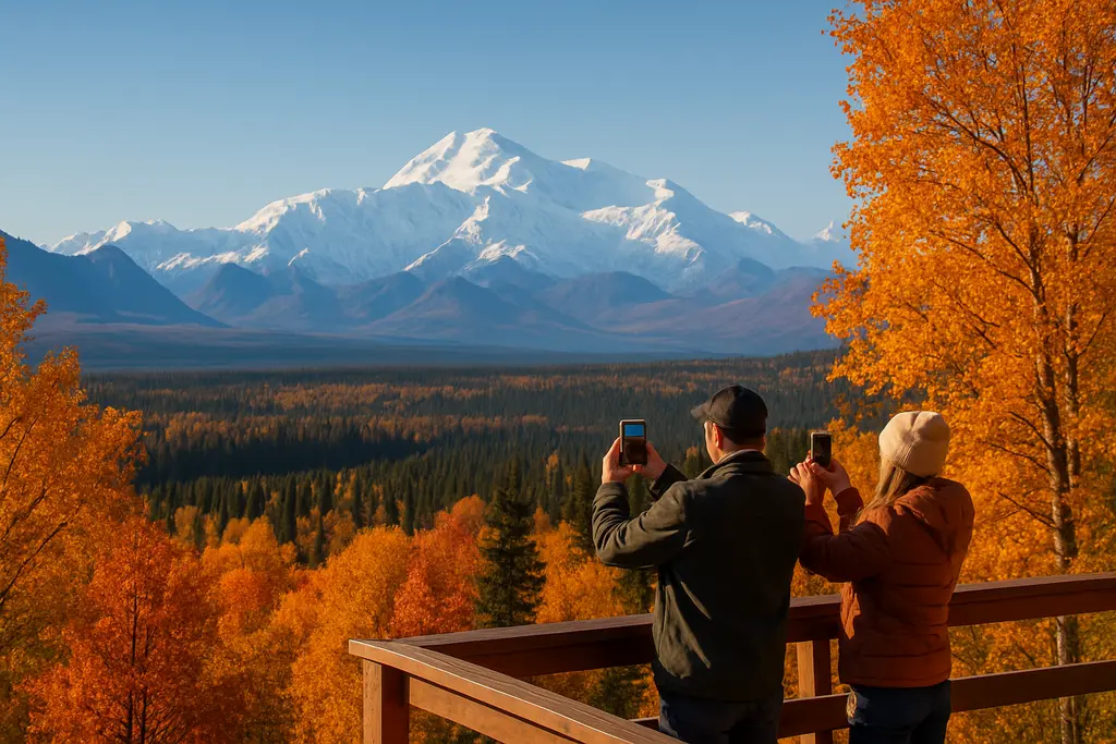
As of September 1, 2026, Denali Road Closures are the central access issue for fall visits because the Park Road does not function as a full east-to-west park drive. Travelers can still have a worthwhile trip, but the planning standard is different from a normal peak-season visit. The key questions are no longer only where to hike or where to look for wildlife. They are which mile marker is open, whether buses are still operating, whether private vehicles are allowed farther into the park, and how quickly fall weather could shorten access.
The National Park Service lists the Denali Park Road as closed at Mile 43, East Fork, because of the Pretty Rocks Landslide, and summer buses travel no farther than the East Fork Bridge while private vehicles are limited to Savage River at Mile 15 during bus operations, according to NPS current conditions. That single mile marker changes how travelers should read maps, lodging plans, and expectations for famous western-road stops such as Eielson, Wonder Lake, and Kantishna.
Why Denali Road Closures Matter For Fall Trips
Denali Road Closures At Mile 43
The Mile 43 closure matters because many classic Denali plans were built around bus access deep into the park. In 2026, that is not the operating pattern. Transit and tour buses during summer operations turn around at the East Fork Bridge, while private vehicle access remains much shorter during the same period. The main planning effect of Denali Road Closures is that the western park is no longer a simple add-on for visitors who book lodging near the entrance and assume a long bus ride will handle the rest.
For fall travelers, the timing is especially sensitive. Summer road access in 2026 runs from May 20 through September 17. After that, bus operations end for the year, services scale back, and weather begins to control daily access more directly. A trip planned for September 10 is not the same access problem as a trip planned for September 25, even if both feel like early fall on a calendar.
Why Pretty Rocks Still Shapes Access
The Pretty Rocks Landslide area has been the main reason for the road break. Research for this report identifies the project as including a $207 million bridge at Mile 45.4, realignments near the Bear Cave landslide at Mile 44.8, slope stabilization, and related mitigation work. The first phase, including the bridge and related infrastructure, was completed in late August 2026. That is a major access development, but it does not mean normal public road service has returned across the western half of the Park Road.
For travelers, the practical distinction is simple: a completed bridge feature can improve non-motorized access before full public bus service resumes. It does not automatically reopen the road to visitor buses, private vehicles, or regular service to farther destinations. Fall planning should treat the road as partially accessible, not repaired in the way most visitors would mean when they ask whether the Denali road is open.
Access By Date And Mile Marker
Private Vehicles, Transit Buses, And Bikes
Through September 17, 2026, the visitor pattern remains tied to summer bus operations. Buses can travel to the East Fork Bridge at Mile 43. Private vehicles can drive only as far as Savage River at Mile 15 while that bus service is active. That creates a split experience: visitors with bus reservations may see more of the Park Road than drivers, but neither group is reaching Eielson, Wonder Lake, or Kantishna by normal road service in 2026.
After September 17, the question changes from bus reservations to road condition. The research notes indicate that in the shoulder period from mid-September through mid-October, private vehicles are typically allowed as far as Teklanika River at Mile 30 if conditions allow. That is not a promise for a specific date. Snow, ice, maintenance needs, or safety decisions can shorten that access.
The Bridge Crossing For Hikers And Cyclists
One meaningful change for active travelers is non-motorized access west of the closure zone. As of August 27, 2026, hikers and cyclists can use the newly completed Pretty Rocks Bridge to cross the landslide zone and continue west of East Fork on foot or by bike, according to Denali current conditions. This is useful for experienced visitors who are prepared for distance, weather, wildlife protocols, and self-supported travel.
That access should not be read as a casual sightseeing substitute. Fall light, temperatures, and surface conditions can change quickly. Cyclists and hikers need to plan turnaround times, carry appropriate layers, and understand that services become thinner after the main visitor season. If the trip depends on reaching a specific place west of East Fork, travelers should verify the latest NPS posting before departure.
What Changes After Bus Service Ends
September 17 To Mid-October
September 17, 2026, is the major planning line for fall visitors because buses along the Park Road end service for the year on that date. After that, there is no simple replacement for the summer transit system. Access may expand for private vehicles to Teklanika River at Mile 30 if the road remains suitable, but that window is weather-dependent.
By mid-October, the road is often closed to vehicles beyond Headquarters at Mile 3.4 when snow or ice make driving unsafe. The research notes describe this as a general fall pattern after significant snowfalls rather than a fixed annual date. That means a traveler booking for October 5 should still watch daily conditions, while someone considering October 18 should assume access could be much shorter.
Winter Visitor Center Timing
Front-country services also shift. The Winter Visitor Center, located at the Murie Science and Learning Center at Mile 1.4, opens for the season on September 24, 2026. That helps preserve some staffed visitor contact after the main summer visitor center pattern winds down, but it does not mean all summer amenities remain available.
Travelers should be cautious about lodging, food, fuel, tours, and shuttle expectations after mid-September. The research supplied for this article did not include current bus fares, campground fees, private tour prices, or business hours. Because those costs and services can change, travelers should confirm directly with official park channels and individual operators before making nonrefundable plans.
Practical Checks Before Booking

Costs, Services, And Uncertainty
Fall Denali planning is less about packing more activities into a short stay and more about reducing avoidable surprises. If a trip depends on a long bus ride, a specific mile marker, or a western-road destination, the 2026 access limits are a serious constraint. If the goal is front-country hiking, photography near the entrance, a quieter shoulder-season stay, or a weather-flexible road trip, the park can still make sense.
For travelers who compare Alaska planning with scenic-drive trips in the Lower 48, a related road-trip planning resource can help frame questions about fuel, weather, and access, but Denali decisions should come from NPS updates. The same check-before-booking habit applies elsewhere, including Washington park closures during wildfire travel.
A Short Pre-Trip Checklist
- Check the latest NPS road condition update within a few days of travel, then again before entering the park.
- Match your date to the access period: before September 17, after September 17, or after likely mid-October weather closures.
- Do not assume private vehicles, buses, cyclists, and hikers have the same access rules.
- Confirm any paid reservation, tour, lodging booking, or rental policy before final payment.
- Build a plan that still works if the road closes earlier than expected because of snow or ice.
This approach is not pessimistic. It is realistic for a northern park where road access, visitor services, and weather are tightly connected. A flexible plan can still include wildlife viewing near open sections, short hikes, visitor center time, photography, and quiet shoulder-season scenery. What it should not include is an assumption that the 2026 fall road experience matches older trip reports from years when buses reached farther west.
Fall Planning Around Denali Road Closures
The Fall Visit That Still Works
Full bus service to Eielson Visitor Center at Mile 66, Wonder Lake at Mile 85, and Kantishna at Mile 92 is not expected until 2027, after work on the western half of the Park Road is completed. That makes fall 2026 a transition period rather than a normal road-access year. Visitors who understand that distinction before booking are more likely to enjoy the trip they can actually take.
Denali Road Closures do not remove the park from consideration for fall travel, but they do require a narrower, better-checked plan. The safest planning language is conditional: if buses are still operating, if the road remains open to a given mile marker, if snow has not shortened access, and if services you need are operating on your travel dates. Those conditions should shape the trip from the start, not become surprises at the entrance station.
For September visits before bus service ends on September 17, the practical focus is understanding the Mile 43 bus limit and Mile 15 private-vehicle limit. For visits after September 17, the focus shifts to weather-dependent private-vehicle access, often no farther than Teklanika River if conditions allow. For trips closer to mid-October, the more cautious assumption is that snow or ice may reduce vehicle access to the Headquarters area. That is the planning reality for fall 2026: Denali remains open to experience, but the road is the trip-defining variable.